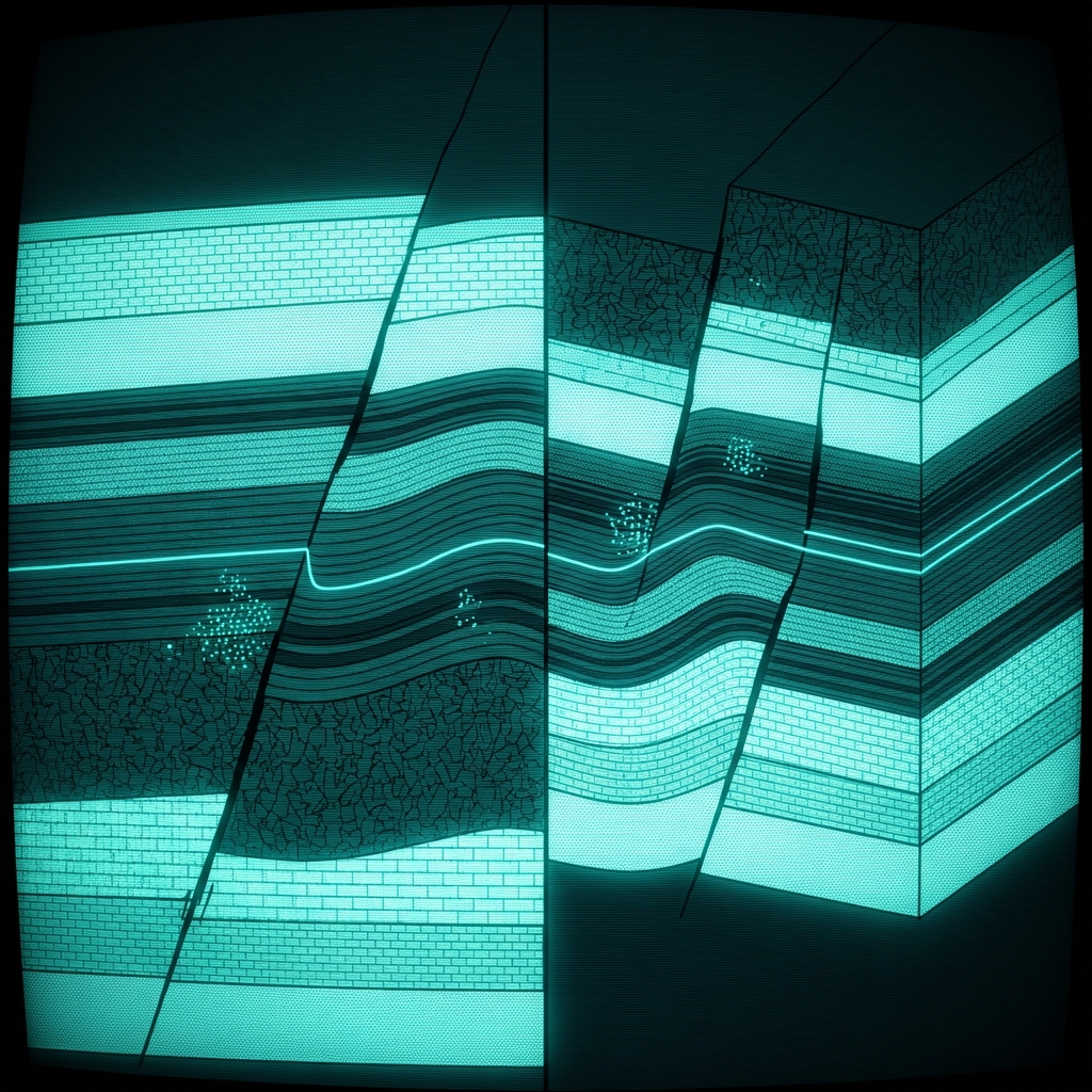
Digital Geologic Map, Carta Valley Fault Zone, Texas
Geologic GIS data layers represent the surface geology and structural features within the Carta Valley Fault Zone, Texas. Each map feature includes attributes such as geologic unit, age, lithologic description, and structural characteristics of faults and folds.
| Namelegal entity | Cityaddress | Stateaddress | ZIP Codeaddress | Street Addressaddress | Full Nameperson | Emailwebsite | Phonephone number | Websitewebsite | @Syncstatus | Charsetcd.@Syncstatus | Charsetcd.@Valueclassification |
|---|---|---|---|---|---|---|---|---|---|---|---|
| Colorado State University | Fort Collins | Colorado | 80525 | 1201 Oak Ridge Drive, Suite 200 | Stephanie O'Meara | stephanie_omeara@colostate.edu | 9704916655 | http://nrdata.nps.gov/amis/nrdata/geology/gis/amis |
Vendor Contact Verification for Government Data Suppliers
A KYB analyst onboarding a geospatial data vendor checks whether the named institution, its listed contact person, and their contact details are consistent and traceable to a legitimate academic or government organization before signing a data licensing agreement.
Insurance Underwriting for Land Near Active Fault Zones
A commercial property underwriter uses the dataset's publication date and originating organization to assess how current the fault zone mapping is before pricing coverage for infrastructure projects in the Carta Valley area, where structural risk directly affects loss modeling.
Due Diligence on Academic Contractors Producing Federal Geologic Data
A procurement compliance officer at a federal agency reviews which universities or research institutions have been contracted to produce official geologic maps, cross-referencing the named contact, their institutional address, and publication record to confirm deliverables match contract scope.
 Digital Geologic Map, Amistad National Recreation AreaDepartment of the Interior
 Mines (Division of Mining and Reclamation)State of California
 Digital Geologic Map of the Bear Paw Battlefield Unit and Vicinity, Nez Perce National Historical Park, Montana (NPS, GRD, GRI, NEPE, BEPA digital map)Department of the Interior
 BLM Locatable Mineral Plans of OperationsDepartment of the Interior
 Draft Terrestrial Landscape Intactness for 2026-2027 Integrated Resource PlanState of California
 BLM Oil Shale LeasesDepartment of the Interior
 30x30 Conserved Areas, TerrestrialState of California
 Basin Characterization Program (Department of Water Resources)State of California
 Bureau of Land Management Coal CasesDepartment of the Interior
 BLM Locatable Mineral Notice Operations
 Colleges and Universities, Baton RougeCity of Baton Rouge
 Economically Significant Oil Spill SitesState of California
 Outdoor Recreation Sites InventoryVermont Center for Geographic Information
 Montgomery County Business ParksMontgomery County of Maryland
 U.S. Electric Utility Companies and Rates by Zip CodeDepartment of Energy
 BLM Gateway South Transmission Line Right-of-WayDepartment of the Interior
 Business and Licensing DataState of Texas
 Transmission Facilities Application Status and LocationMontgomery County of Maryland
 Demand Response Across the Continental USDepartment of Energy
 Guides Currently Licensed in New York StateState of New York